
Overview
Ripple Pond Proposed Ecological Reserve is an area identified for protection under the Wilderness and Ecological Reserves Act. The Provincial Government has asked Wilderness and Ecological Reserves Advisory Council to engage the public on this site and make recommendations about future protection.
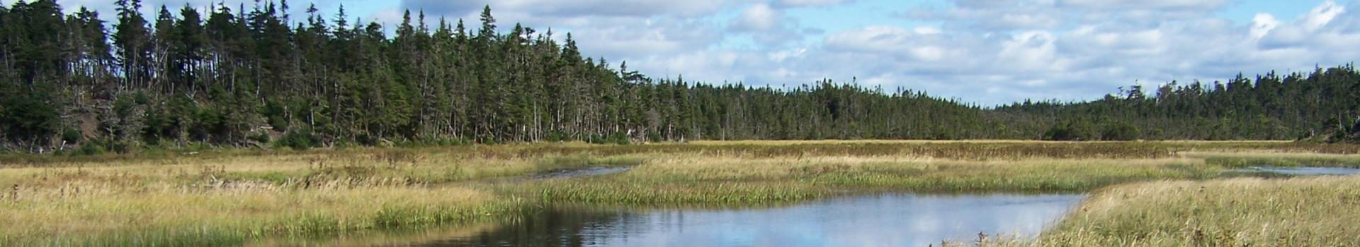
The proposed Ripple Pond reserve is a special place for local people and wildlife. The moist climate of the Avalon forest creates habitats where many rare lichen species thrive. Whether you are a hunter, angler, a near-by seasonal cabin owner, or a frequent paddler within the Colinet River watershed, this place likely holds memories and meaning to you, your families, and your communities. Conserving this wild space means that it will stay the same for generations to come. Reserves like this one are intended to be places where locals and visitors alike can enjoy hunting, fishing, camping, snowmobiling, boating, and other outdoor activities, just as they do now.
Quick Facts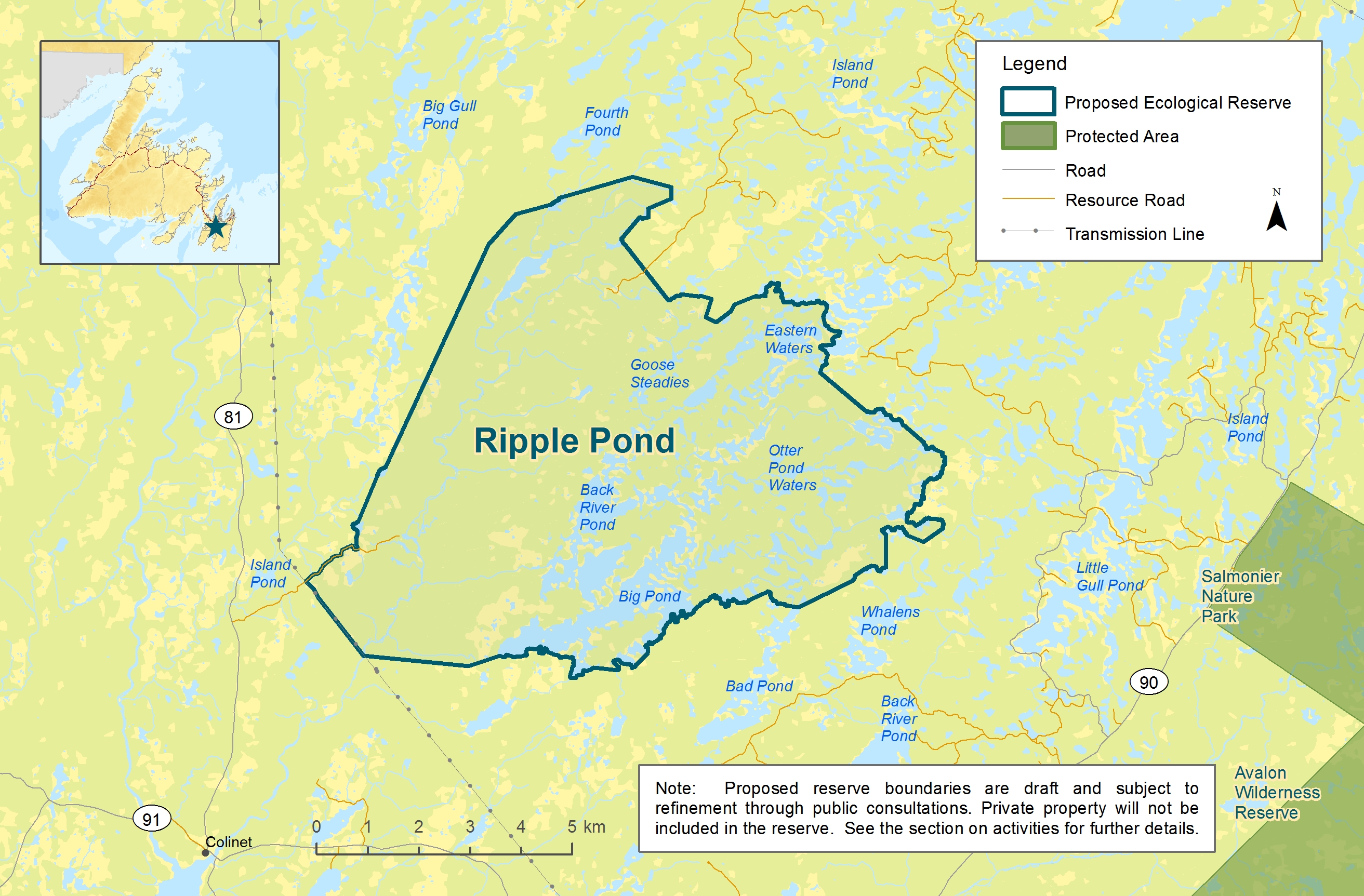

Size: ~70 km2
Location: Central Avalon (west of the Salmonier Line, Route 90)
Key Features:
- Represents the Avalon Forest Natural Region. See Newfoundland Ecoregions (arcgis.com) for more details.
- Ribbed moraines (large wavy ridges formed by glaciers) create unique forest patterns.
- Moist climate creates a forest rich in lichens.
- Relatively wild, with little human development.
- Contains a large part of the Colinet River watershed and its wetlands.
- Close to community and cabin areas, making it a popular wilderness recreation spot.
How Can You Get Involved?
The initial public engagement sessions for this proposed protected area are ongoing. We thank everyone who participated and shared their valuable insights. This page will be updated with any new information as the process moves forward.
Your involvement in this process will help shape what a future reserve looks like and how it can be managed. Your input ensures that we honour local interests, needs, and traditions.
- Keep up to date on news and upcoming public involvements related to Ripple Pond by signing up for our mailing list. Email werac@gov.nl.ca or click the sign-up link below.
- If you have any questions or concerns about Ripple Pond Proposed Ecological Reserve, reach out to the Wilderness and Ecological Reserves Advisory Council (WERAC) at werac@gov.nl.ca or 709 632-0843.
- Stay informed about planning activities through this page and the Department of Environment and Climate Change website.
Sign Up for the WERAC Mailing List
Interactive Map
Is there an area in the region that you would like to tell us about? Use the interactive map below to highlight an area or activities important to you in the Ripple Pond area.
Please note you must log in or register to complete the interactive map. Any submissions will be used to guide planning and outreach and help in understanding what is important to people who use the area.
Click Here to Use the Interactive Map
Privacy Statement
The collection of information is done under the authority of section 61(c) of the Access to Information and Protection of Privacy Act, 2015, for the purpose of collecting public feedback on the proposed protected area.
Any personal information that may be received will be governed in accordance with the Access to Information and Protection of Privacy Act, 2015 and will only be used for the purpose of planning, engagement, and reporting back regarding the proposed protected area.
If you have any questions about how this information will be collected, used, and disclosed, please contact the Department of Environment and Climate Change ATIPP Coordinator at atippecc@gov.nl.ca.
Contact Us
If you have any questions or comments, please contact the WERAC Secretariat at 709 632-0843 or werac@gov.nl.ca.